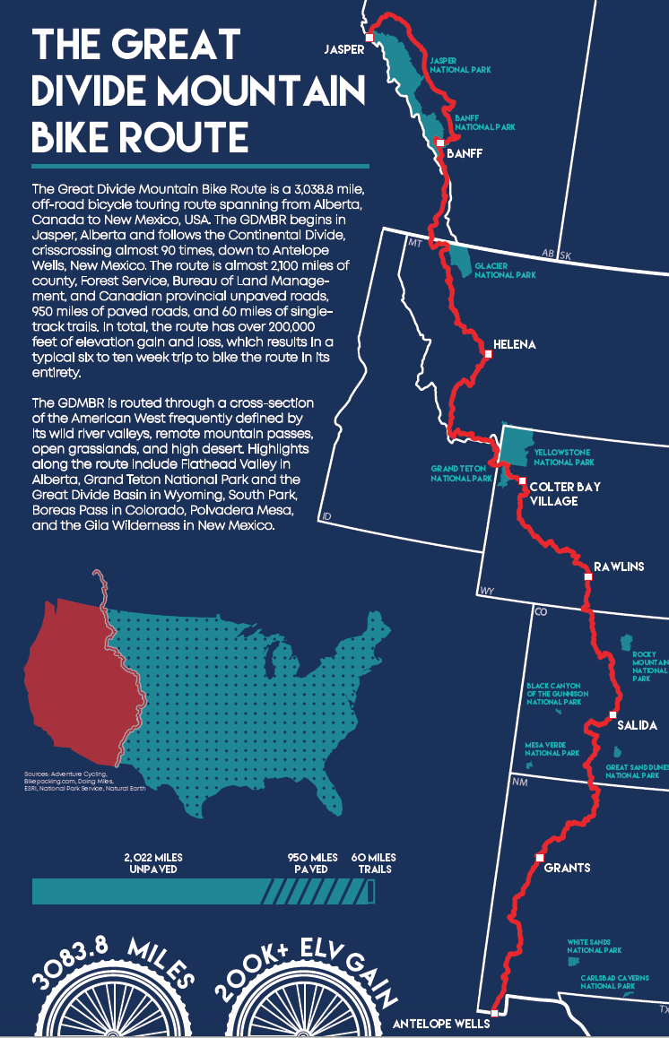
A map of the Great Divide Mountain Bike Route, a 3,038.8 mile, off-road bicycle touring route spanning from Alberta, Canada to New Mexico, USA. The GDMBR follows the Continental Divide (emphasized in the graphic below the main text), crisscrossing almost 90 times. The route itself is made up of county, Forest Service, Bureau of Land Management, and Canadian Provincial roads -- then in turn, made up of 2,100 miles of unpaved road, 950 miles of paved roads, and 60 miles of single-track trails.
The main focus of the map highlights the Great Divide Mountain Bike Route itself, picking out large cities on the route, as well as US and Canadian National Parks along the way. The infographics along the side of the map pull out interesting facts about the GDMBR, such as its position along the Continental Divide, road make-up, and extreme elevation gain.
Tools: ArcMap, Adobe Photoshop, Adobe Illustrator